 With the support of Sentinel Asia, the International Charter
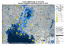
Space and Major Disasters and the Canadian Space Agency, GED generated several Flood Footprint maps for the heavy rainfall events of the southwest monsoon season in 2012 in the greater Metro Manila area.
The maps combined the physical flood footprint and data from the Department of Social Welfare and Development on the Number of Affected persons.