Located in the tropics within the Pacific Rim of Fire and being archipelagic, the Philippines is hazard-prone and most vulnerable to impacts of climate change. Local government units are required to prepare Comprehensive Land Use Plans or CLUPs to plan the development and growth of their areas. CLUPs are important because the way we allocate land to specific functions or uses influences our exposure and susceptibility to disasters.
The significant impacts of disasters and the projected impacts of climate change created the need to develop, to impart and set-up a ridge, river to reef rural-urban land use evaluat ion system for climate change adaptation and disaster risk management or R3 RULES for CCA-DRM.
This RULES for CCA-DRM project is supported through the extended JAXA ALOS (Advanced Land Observat ion Satellite) Research Agreement. In addition, RULES for CCA-DRM was accepted to benefit from in-kind grants by Planet Action, an open initiative spearheaded by SPOT Image, CNES (the French Space Agency), together with Digital Globe (QuickBird), ESRI, (ArcGIS: ArcView, ArcEditor, Arc-Info), ITTVIS (ENVI) and Trimble Geospatial Munich (e-Cognition). This project then features utilization of the ALOS products, namely AVNIR-2, PRISM and PALSAR, and SPOT imageries. SRTM and LANDSAT are likewise used, especially for context analyses and SPOT for the priority study areas.
Other partners of the project are Ateneo de Manila University (ADMU), Ateneo de Naga University (ADNU), Xavier University (XU), Ateneo de Davao University (ADDU) and Ateneo de Zamboanga University (ADZU).
The Study Areas
The study areas of R3 RULES correspond to critical and strategic Regions in Bicol (Southeastern Luzon) and Mindanao (South of
the Philippines). These study areas are:
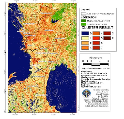
• Metro-Manila, National Capital Region
• Naga City, Camarines Sur, Region V: Bicol
• Cagayan de Oro City, Misamis Oriental, Region X: Northern Mindanao
• Davao City, Davao del Sur, Region XI: Southern Mindanao
• Zamboanga City, Zamboanga del Sur, Region IX: Western Mindanao
The areas represent ridge, river to reef rural- urban ecosystems that experience unique climate and associated geophysical and
ecological risk. R3 RULES for CCA-DRM would help in better understanding the socio-environmental context of the said study areas and how best to address planning and development issues to formulate more adaptive and risk-sensitive CLUPs.
The main beneficiaries are relevant stakeholders and communities as affected by the CLUPs prepared by the LGUs. It is intended
that optional CLUPs and strategies would be rendered more climate-adaptive and disaster risk-sensitive.
Local Actions and Impact
The R3 RULES for CCA-DRM project contributes to local action by providing a practical tool in the form of a project case work or PCW that LGUs can adopt, develop and learn from. A participatory process with validation from LGUs, other stakeholders and communities is advocated. Space and
evidence-based decision-support can better capture, visualize and analyze the complexity of ground conditions.
The analysis through the tools of RS-GIS and more realistic and realizable development and CCA-DRM options may help LGUs in the creation of CLUPs which contribute to the resilience of communities to disasters and climate change.